Introduction to Udawalawe National Park
Udawalawe National Park is one of Sri Lanka’s most celebrated wildlife sanctuaries and a must-visit destination for nature lovers, photographers, and adventure seekers. Located on the boundary of Sri Lanka’s southern and central provinces, this iconic park is world-famous for its large population of wild Asian elephants and open grassland landscapes that make wildlife viewing remarkably easy.
Covering roughly 308 square kilometers, Udawalawe National Park offers a raw and authentic safari experience. Unlike dense jungle parks, its wide plains and water reservoirs allow visitors to spot animals in their natural habitat with clarity and comfort. From majestic elephants to elusive leopards, the park delivers unforgettable moments for travelers of all ages.
History and Formation of Udawalawe National Park
Udawalawe National Park was officially established in 1972. Its primary purpose was to protect wildlife displaced by the construction of the Udawalawe Reservoir on the Walawe River. Over time, the area evolved into a thriving ecosystem that supports a diverse range of flora and fauna.
The park also plays a vital role in water catchment protection and environmental conservation. Today, it stands as a shining example of how development and wildlife preservation can coexist when managed responsibly.
Geography, Climate, and Landscape
The landscape of Udawalawe National Park is dominated by open savannah grasslands, scrub forests, and wetlands. This unique terrain sets it apart from many other national parks in Sri Lanka.
Climate: Warm and dry for most of the year
Key feature: Udawalawe Reservoir, attracting wildlife year-round
Best visibility: Due to sparse vegetation
The dry climate encourages animals to gather near water sources, offering visitors excellent wildlife sightings throughout the day.
Wildlife Highlights of Udawalawe National Park
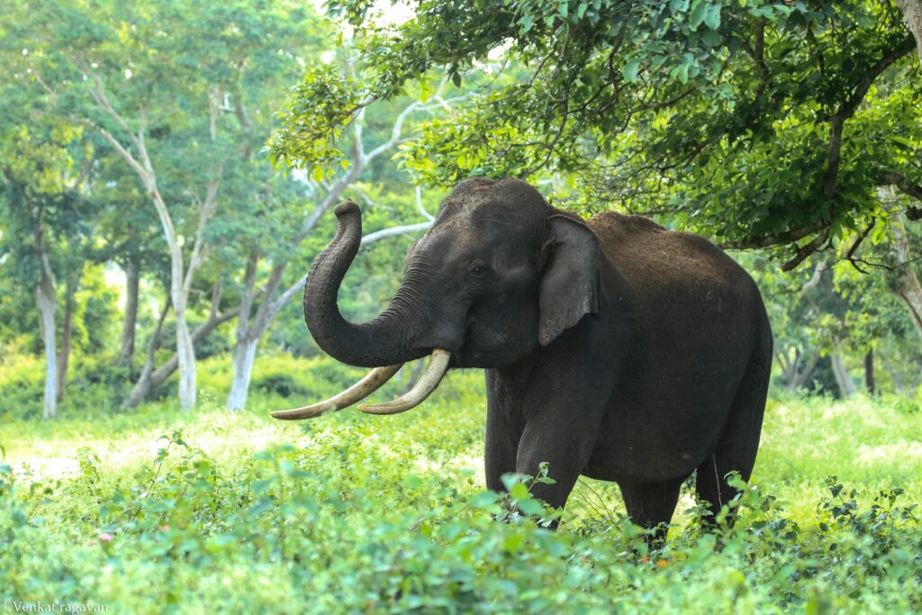
Udawalawe National Park is best known for its elephants, but its biodiversity goes far beyond that.
Asian Elephants
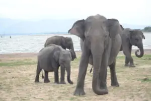
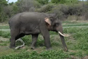
The park is home to over 500 Asian elephants. Seeing them roam freely, bathe in waterholes, or care for their young is the highlight of most safaris.
Mammals
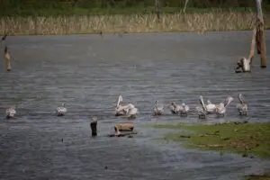
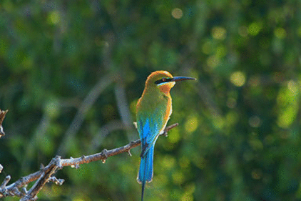
Birdlife
Birdwatchers will find Udawalawe National Park especially rewarding, with over 180 bird species including
Crested serpent eagle
Grey-headed fish eagle
Painted stork
Sri Lanka junglefowl
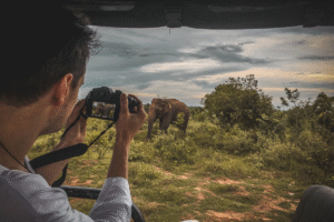
Safari Experience in Udawalawe National Park
A safari in Udawalawe National Park is both thrilling and accessible, making it ideal for first-time safari-goers.
Jeep Safaris
The open terrain ensures excellent visibility, allowing visitors to observe animals without dense foliage blocking the view.